
Physical Geography

Plates
PLate Movement

Lateral Ship
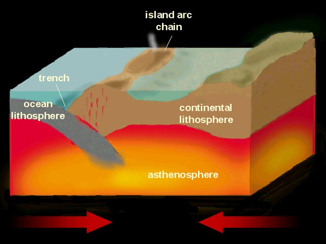
Convergent
Divesing

Earthquakes
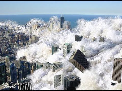
Tusnamis
Definition
Geologic History
Eras
Mesozoic Era
Precambrian Era
Paleozic Era
Cenozoic Era
/GettyImages-476873389-5c44fc6146e0fb0001afe477.jpg)
Pangea
Proof
Hurricanes: Hurricane Dorian 2019
Chacteristics
Dorian
More information
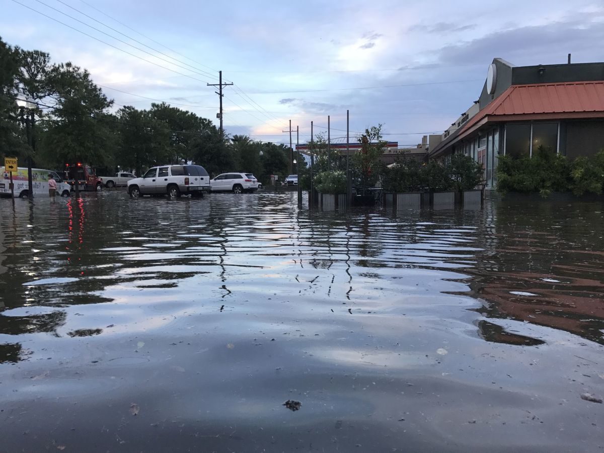
Flooding: Alberta flood 2013
The Affects
Climate
Factors affecting climate
Near bodies of water
Relief
Elevation
Wind Direction
Oceans Currents
Latitude
Differecne between Cilmate and weather
Weather
Climate
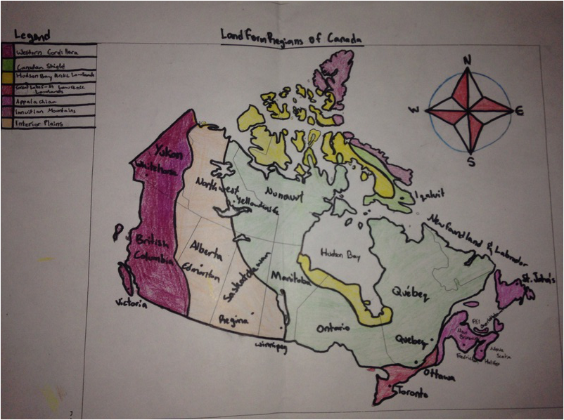
Canada's Land-form Regions
Difference between Region and Landform region
Landform Region
Region
Canada's Land-form Regions
Canadian sheild
Appalachian Mountains
Western Cordillera
Innuition Mountains
Great Lakes/St. Lawrence Low Lands
Interior Plains
Arctic Low Lands
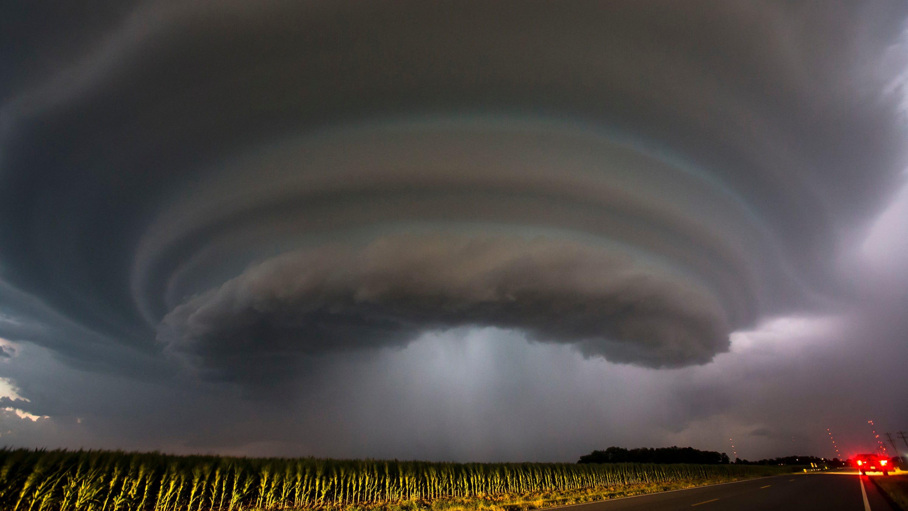
Tornadoes: Ottawa area 2018
Tornadoes
Ottawa 2018

Wild fire: Fort McMary May 1, 2016
About the wild fire