Tuiles vectorielles
Sujet principal
tuile_vectorielle
- auteur de la donnée
calque = shapefile
[point]
champ
valeur
calque = shapefile
[ligne]
calque = shapefile
[surface]
calque = shapefile
[image]
socle_geographique
- CAUE du Nord
soclegeo-elt-lign
[ligne]
soclegeo-str-surf
[surface]
soclegeo-str-lign
[ligne]
soclegeo-str-poin
[point]
soclegeo-sit-surf
[surface]
soclegeo-sit-lign
[ligne]
soclegeo-sit-poin
[point]
soclegeo-ter-surf
[surface]
soclegeo-ter-lign
[ligne]
soclegeo-ter-poin
[point]
soclegeo-grdter-surf
[surface]
titre
theme
eau
plan_d_eau
humidite
socle
plateau
vallee
notion
hierarchie
strate
sous-sol
sol
relief
hydrographie
enjeu
typologie
soclegeo-grdter-lign
[ligne]
soclegeo-grdter-poin
[point]
structure_humaine
- CAUE du Nord
structhum-elt-surf
[surface]
structhum-elt-lign
[ligne]
structhum-elt-poin
[point]
structhum-str-surf
[surface]
structhum-str-lign
[ligne]
structhum-str-poin
[point]
structhum-sit-surf
[surface]
structhum-sit-lign
[ligne]
structhum-sit-poin
[point]
structhum-ter-surf
[surface]
structhum-ter-lign
[ligne]
structhum-ter-poin
[point]
structhum-grdter-surf
[surface]
titre
theme
notion
hierarchie
epoque
proto-histoire
gallo-romaine
medievale
classique
industrielle
entre-deux-guerres
deuxieme_reconstruction
trente_glorieuses
contemporaine
enjeu
typologie
aire_d_alimentation_des_captages
canal_de_liaison
marais_maraicher
plan_d_eau
bocage
boisement
paysage_d_openfield
vignoble
campagne_manufacturiere
paysage_d_extraction
littoral_industriel
vallee_industrielle
secteur_eolien
ville_et_agglomeration
habitat_rural_mixte
fortification
usage
date
structhum-grdter-lign
[ligne]
structhum-grdter-poin
[point]
notion
typologie
administration-guerre-economie
- CAUE du Nord
population
[point]
epoque
nombre-en_milliers
peuple
[point]
epoque
adminguerreco-grdter-surf
[surface]
titre
typologie
adminguerreco-grdter-lign
[ligne]
titre
typologie
etatmajor-vecteur
- Département du Nord
toponymes-1870
[point]
toponymie
type
toponymes-1930
[point]
toponymes-1950
[point]
toponymes-1970
[point]
patrimoine-1870
[point]
toponymie
type
patrimoine-1930
[point]
patrimoine-1950
[point]
patrimoine-1970
[point]
axes_routiers-1870
[ligne]
toponymie
axes_routiers-1930
[ligne]
axes_routiers-1950
[ligne]
axes_routiers-1970
[ligne]
axes_ferroviaires-1870
[ligne]
toponymie
axes_ferroviaires-1930
[ligne]
axes_ferroviaires-1950
[ligne]
axes_ferroviaires-1970
[ligne]
reseau_hydro-1870
[ligne]
toponymie
reseau_hydro-1930
[ligne]
reseau_hydro-1950
[ligne]
reseau_hydro-1970
[ligne]
ruptures_de_pente-1870
[ligne]
type
ruptures_de_pente-1930
[ligne]
ruptures_de_pente-1950
[ligne]
ruptures_de_pente-1970
[ligne]
ocs-1870
[surface]
type
ocs-1930
[surface]
ocs-1950
[surface]
ocs-1970
[surface]
ocs-1998
[surface]
ocs-2006
[surface]
unites_paysageres
[surface]
titre
code
systemes_paysagers
[surface]
entites_paysageres
[surface]
cooperation_transfrontaliere
terrain_de_sport
cimetiere
zone_de_vegetation
[surface]
NATURE
surface_hydrographique
[surface]
NATURE
troncon_hydrographique
[ligne]
NATURE
PERSISTANC
FOSSE
NAVIGABL
NUM_ORDRE
ORIGINE
SENS_ECOUL
LARGEUR
BRAS
NOM_C_EAU
cours_d_eau
TOPONYME
IMPORTANCE
batiment
[surface]
NATURE
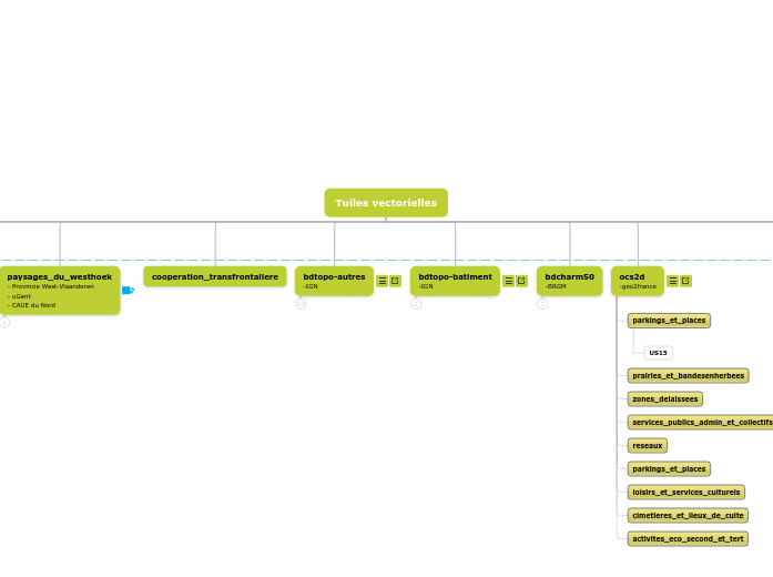
bdcharm50
-BRGM
alluvions_recentes
parkings_et_places
prairies_et_bandesenherbees
zones_delaissees
services_publics_admin_et_collectifs
reseaux
parkings_et_places
loisirs_et_services_culturels
cimetieres_et_lieux_de_culte
activites_eco_second_et_tert
orientation
orientation-ter-poin
[point]
titre
theme
notion
piste
enjeu
eau
nature
productivite
habitat
culture
orientation-ter-lign
[ligne]
titre
theme
notion
piste
enjeu
eau
nature
productivite
habitat
culture
orientation-ter-surf
[surface]
titre
theme
notion
piste
enjeu
eau
nature
productivite
habitat
culture
orientation-sit-poin
[point]
orientation-sit-lign
[ligne]
orientation-sit-surf
[surface]
orientation-str-poin
[point]
orientation-str-lign
[ligne]
orientation-str-surf
[surface]
orientation-elt-poin
[point]
orientation-elt-lign
[ligne]
orientation-elt-surf
[surface]
secteur_a_enjeux
mnt-relief
- ???
relief_ocre
[image]
relief_noir
[image]
relief_gris
[image]
premiere_guerre_mondiale
socle
paysage - eau
socle
lieux de vie - habitat
ville - productivité
classique
Eau
paysage - nature
acteur - culture (guerre) ou ville
récit
abandonné
socle_geographique (v1)
source
[point]
point_haut
[point]
cours_d_eau_naturel
[ligne]
ligne_de_partage_des_eaux
[ligne]
courbe_de_niveau
[ligne]
derniere_transgression_marine
[ligne]
plateauvallee-ter
[surface]
plateauvallee-sit
[surface]
type
bassin_versant-grdter
[surface]
bassin_versant-ter
[surface]
bassin_versant-sitoutstr?
[surface]
cordon_dunaire
[surface]
geologie_simplifiee
[surface]
unites_morphologiques
[surface]
administration-guerre-economie (v1)
front
[ligne]
flux_commercial
[ligne]
ressource_eco
[surface]
epoque
type
production_eco
[surface]
epoque
type
bassin_textile
bassin_metallurgique
bassin_industriel
consommation
[surface]
administration
[surface]
epoque
type
allemagne
allies
pays_allies_occupes
pays_neutres
territoires_convoites
provinces_unies-1648
provinces_unies-1713
principaute_de_liege
royaume_de_france-1626
royaume_uni
royaume_de_france-1678
saint_empire_germanique
zone_detruite
[surface]
epoque
type
sans_dommage
moindrement_touchee
dommage_important
completement_devastee